Will height change cause a crash

You asked, “Are Mavics the same as mini 4 pro’s ?” The answer is a resounding YES, they are both “Quadcopter Drones built by DJI…” and that is about where the similarities end… As new models come out with new capabilities, the Fly App, based on the model flown, shows the new capabilities.

This video may help you better understand your Mini 4 Menus…

And this video shows the menus for the DJI Mavic Pro…

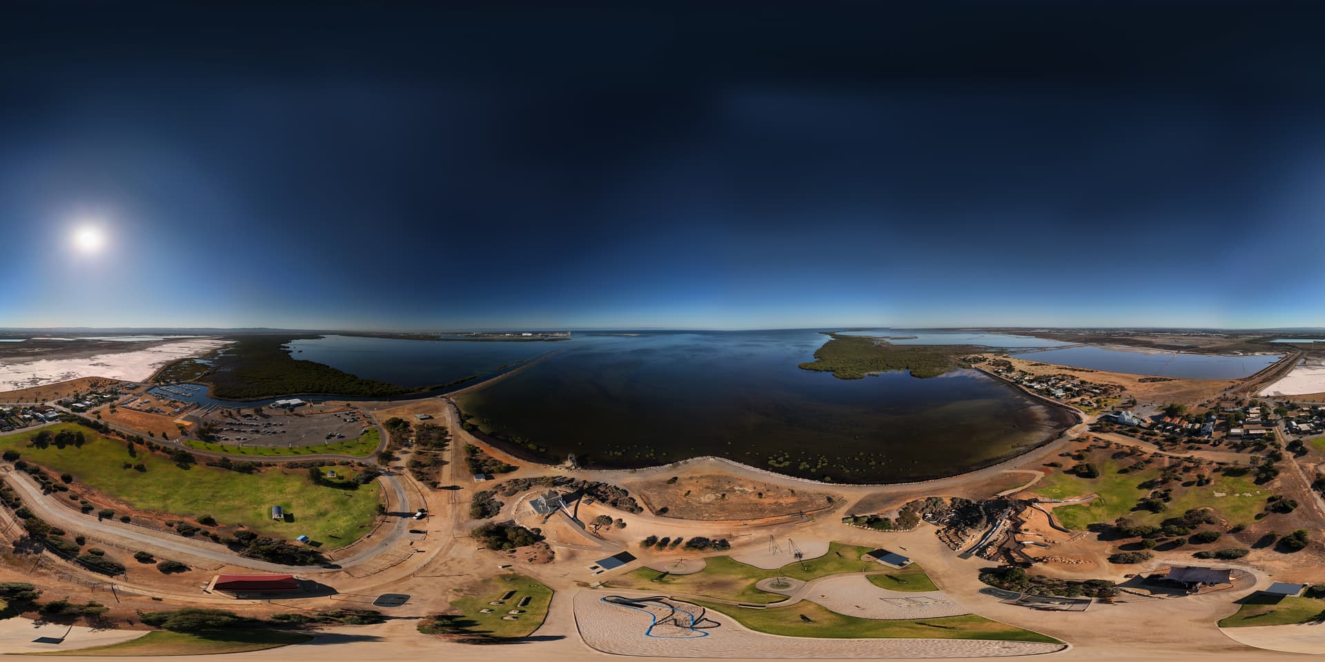
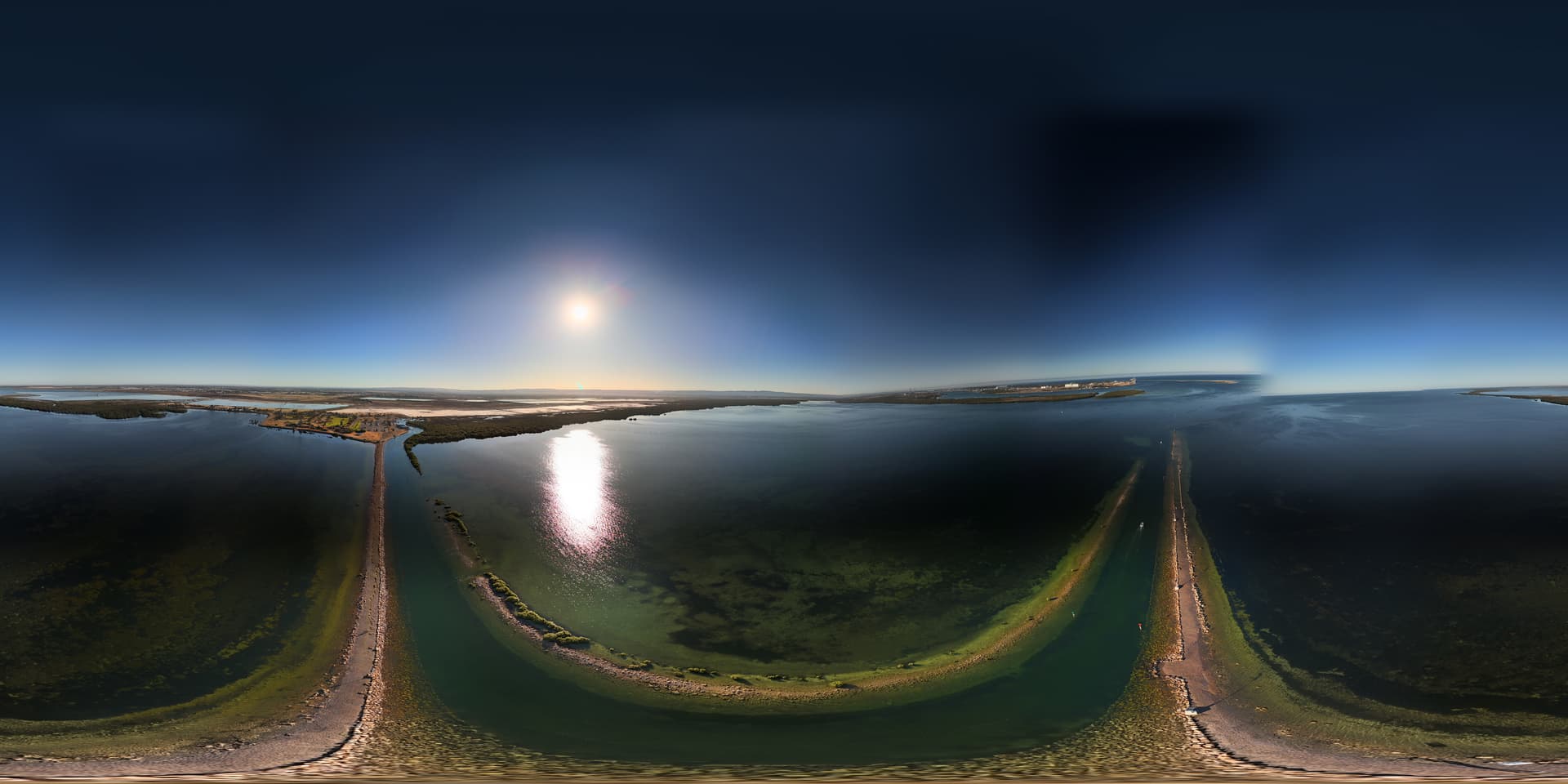
When you launch from the top of the Dam and then fly over the dry side, remember, the “altimeter” will show negative values, so you will not know just how close you are to the ground… And watch the Satelite count, the dam will block a whole bunch of them and you might wind up flying in Atti Mode, meaning the GPS capabilities will not function. The drone will still fly, but it will be at the mercy of the wind and your ability to fly a non-GPS drone…

If you are trying to track swans on the water, there probably is not enough contrast for the lock to maintain a good sight…

When I was on Darwin Airbase, it was in the mid '80s (that’s like 40-years ago…) and I am sure a lot has changed…

As for moving the pilots and their household goods in a C-130, it does not happen. The military is not trained to move households, they are trained to bomb and blow up households… L :joy: L . . .

I was only 13-years old in 1963 when the last mushroom cloud went up, I was there in the mid-80’s. The final clean up did not occur until the late 90’s…

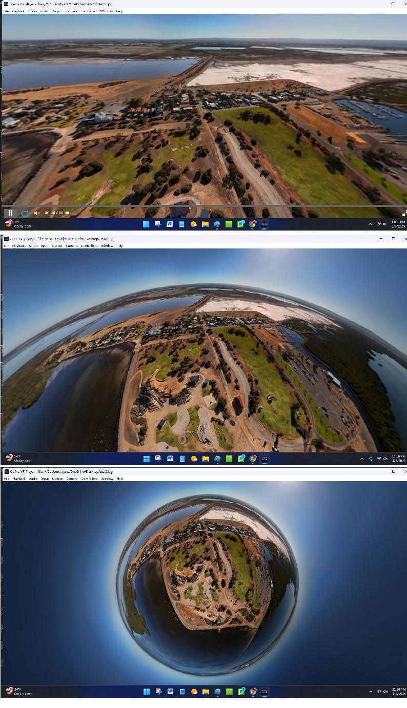
My phone and my tablets all will record anything that appears on the screen, if that is what you mean…

As I wrote I film and video in cine mode and all the controls are set low… Normal is all average, but Sport mode is for fun and all the controls are set high, for maximum speed, turning, yawing, etc… It’s when I want to Zoom like a fighter aircraft…

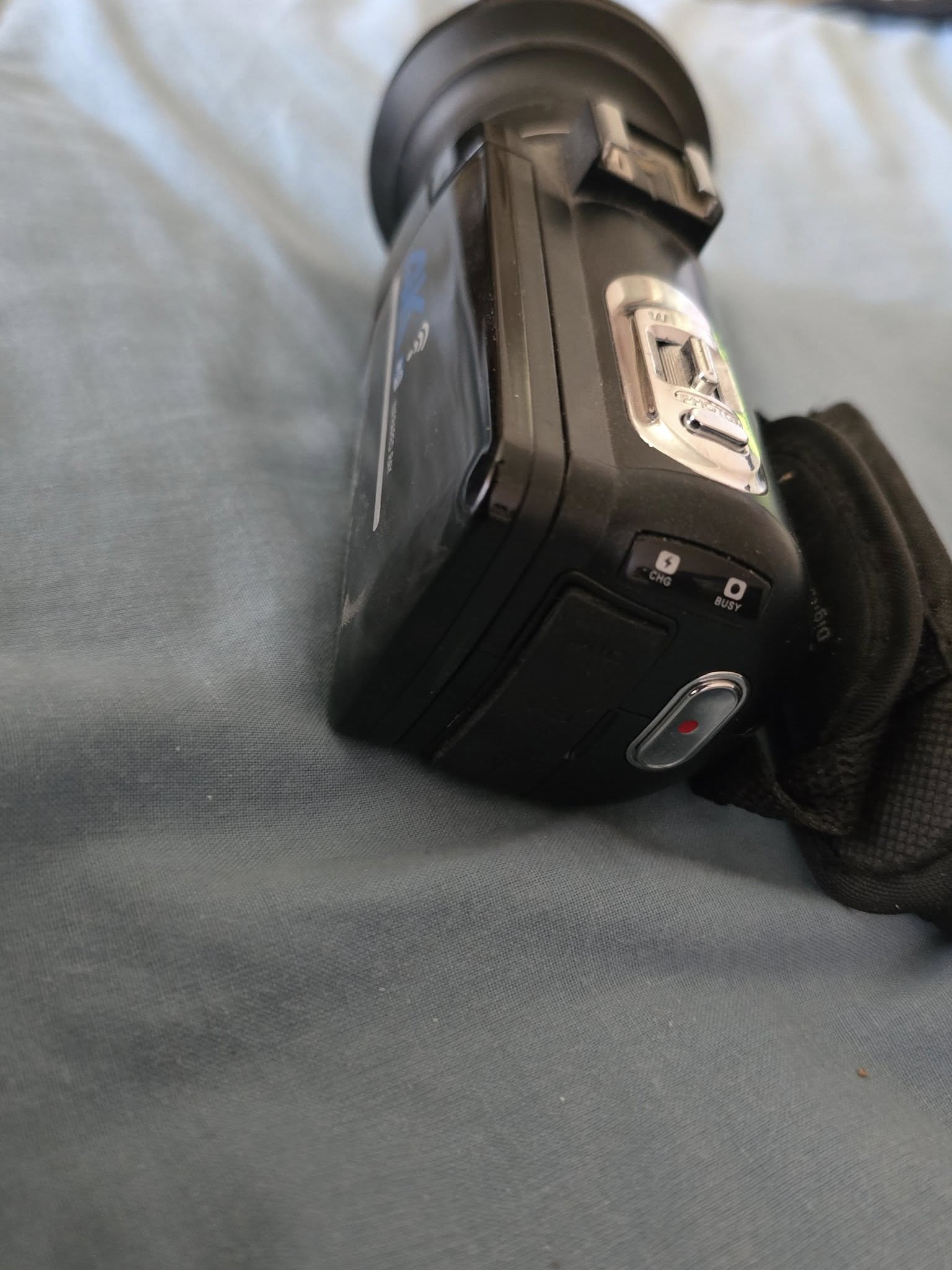
You never mentioned what that “thing with the RED Arrow” was in the almond video. IT looks like a garage door opener… or an old remote control for a TV…

Funny, you should end with “Ciao”, One of the other places I was assigned was to NATO Headquarters, Southern Europe, in Naples, Italy in the late '70s. That was my absolute favorite assignment…

Talk to you later…

1 Like

G’day again. The thing in the video is the 4k camera. i was filming on the phone as the 4k camera had run out of memory card.
Im pretty sure ill keep the majority of the satellites as ill still have 90 degrees of open space above me.
If i do it the way im hoping, ill be 30 or 40 foot back from the wall. as for wind, it will be a calm day for me to try this. At least for the first time. just to see what it does.
I dont use sport mode. I find it is a little too fast for me at this point.
I spotted a nice mangrove i could drone over, and its not restricted space, however a few hundred yards away is the sub building site. i think they would take a dim view of me droning, even though its not of them lol
I have seen some videos that warn not to drop too close to the water as the reflections from the water confuse the sensors.
Next couple days are over 100 then rain. after that i should be good to pick a day with light winds and go for the dam.
Until next time …


this is what your seeing

The issues with the sensors is that they might not interpret the water as the ground. For example, if you manually lower your drone towards the landing pad, it will see the pad as the ground and go into landing mode. The water reflects the image and if you did the same, it might fly right into the water… flying over water is not as much an issue as long as you do not get a lazy finger and unintentionally lower the drone as you fly. As long as you fly level, the drone will fly level, right over the water…

Find some place wide open and put that baby into sport mode and let loose… Then “check the brakes…” As the drone is flying past you at high speed, just release the throttle and watch that baby “slam on the brakes…” It is interesting, but it’s not something I would recommend you often do. I think it puts a bit of a strain on the arms as the drone goes into full reverse mode to stop. I have never heard of anyone ever say that their drone broke an arm stopping.

Be Good!

I did experience that my Mini 4 Pro took a high voltage power line as ground and starting to land while I was lowering the drone (only possible to see that particular line through the camera, not from here I stood on the ground). I managed to stop the landing, but got a warning that one motor was blocked, and the camera was bounced out of place. I had an incredible luck, because at that time I used propellers less brittle than the original ones (so they did not break), and underneath it was a powerful stream. I have a short video of some scaring moments, but must admit that even if I have been flying a lot over water, this has not caused me any concern.

1 Like

lol i have done that. the RTH button is 1 press for brakes. i tested that first day.
Im not much for speed on the drone. im more the slowly slowly type. get it in to position and make sure the shots right. i gave it a few laps of the oval at high speed, but i keep it fairly sedate.
If i keep my speeds in the lower end of what it can do, it might last a little longer lol
Time for bed. over 100 again tomorrow. catch you in a few hours

I did not press the RTH button at this occasion, but when you are above something that is considered as ground and you keep holding the down stick, it will land regardless of what’s underneath. This is how I do the hand catching, as it will resist at the first, but when you continue holding the down stick, it will start (very slowly) to land, and when no further down movement is registered, the propellers will stop.

scary stuff coming down on the power lines.
With the water, im only afraid because im new to flying.
The beach videos i did were no problem. The drone did exactly what i asked of it.
Im still just new to it. I will learn.
Good to see you got the drone back safe.

Yes I think I had my good share of luck that day (all flights were at the same day).
Here is one of my many flights above water:

but at the end the RTH went haywire. This was most likely due to the low sun and potencial fingermarks on the sensors, causing the drone to perceive a lot of obstacles that weren’t there.

Still it seems like the RTH on the Mini 4 Pro has improved, because I did a test where my Air 3S excelled, and I did not believe my eyed when I saw that the mini 4 Pro managed to do the same (has not done so on previous tests).

Cool videos. that was a long time to be over water lol. if mines down to 2 lights i bring it home. im still chicken of it going for a swim. you have done well.
When i hit the RTH it normally finds a gap and goes for the sky, and then flys at 15 meters, then drops down to me. Ive not seen one that follows the same path out.

I was at St Kilda playground and marina, and fishing rock wall not long back.
I got over the water a bit. I posted a vid of the still shots on the day.
I got some vids as well.
It was my training day on POI. So alot more circling around then normal.
But thats part of training. repeat until its second nature.

I did a couple 360 pix while i was at st Kilda.
Yours come up as a sphere and mine come up as a warped photo.
I went to add them to google maps, and google maps has the spheres loading in .mp4
all of the 360 shots i have taken are .jpg format. I feel i might be doing something wrong.


Once i added these 2 pix to facebook, it had the full thing. i could use the mouse and turn and go up and down. but it doesnt do a sphere image like thunders one above

Just a quick note about the birds. I mentioned previously that you do not have to worry about pigeons, but seagulls are something completely different. They will attack a drone and they are big, tough birds and they only need to hit one of your propellers and if it breaks a blade off, your drone is going down…

If seagulls or any other birds like crows, raptors (falcons, hawks, eagles, etc…) take an interest in your drone, climb quickly and do not worry about breaking he height law. If they attack your drone and bring it down, it is now a SAFETY issue and you can break that limit for safety reasons. If that drone comes down and hits a person, or a vehicle, it could cause a lot of injuries or worse…

Climbing quickly usually discourages these birds since they usually attack by diving but if they have to climb, nit puts them at a distinct disadvantage, they are slow and they are defenseless since they use their feet (talons…) to attack…

1 Like

If you want to see what your 360-degree photospheres look like on your computer, download the “GoPro VR Player 2.3” App, it is free and it will allow you to open your 360s in any direction, at any zoom, and you can then save a screen shot that does not look weird…

I took your photo of St Kilda Adventure Playground and edited it in the software and here are three versions I saved… The top is the normal view, the middle is slightly zoomed in, and the bottom is zoomed out all the way.

I also thought about publishing your photo, but then it would be under my user name, “LoudThunder Drone” and that would not be fair to you. You took it, you own it, and you should publish it…

Here are the most basic instructions:

  1. On your computer, open Google Maps.
  2. Search for a place.
  3. After you select a place, scroll down.
  4. Click Add media. Google Photos.
  5. Select the photos or videos you want to upload.
  6. Click Select.

If you need more help, Google it or check YouTube Videos…

FInally, here is one of mine… Remember, in a 360 degree Photosphere, you can zoom in, and scroll all around, it is a great way to capture the entire scene in one photo… (actually 25-photos that your fly software stitches together into one photo…

1 Like

Your up late :slight_smile: yeh i have done this but it wont accept the 360 picture
If you can get it to work, feel free. i have one for the playground and one at the end of the rock wall.
The fact that its in your name dosent worry me lol. here is a pic of when i try and up load


playground:

rock pile :

Thanx for your efforts. i dont know why i wont allow the files im trying to give it.
im guessing you will see this in the morning as its got to be heading to midnight there.

I posted the photo of the park with the comment “Photo taken by Gordon Mackenzie “Raver” with his DJI Mini 4 Drone” It show up under “Latest:” and “Photos” not 360 globes.

But the photo shows up without being a 360 under the latest without the comment, I reported it as a problem to Google.

I’ll try to figure what else is going on…

Later…

1 Like

i just had a look. the single picture is up there but its not 360. just a picture. maybe google is having a moment

That may have to do with your RTH setting. I have set mine to Optimal.

I have loaded several 360 degree pictures to Google photo, Google maps and Facebook. All of them turn out as a picture that pops up as expected, where you can turn around in the picture.

You ar right about the birds of pray, but the problem with those is that they come so fast that you really do not know what happens. Another issue is that unless you have updated you Mini 4 pro to C1, you will not be able to raise above 120 meter anyhow. Still, the best way (when you notice the bird) is to raise up. I had an encounter with a peregrine falcon (three consecutive ones), but due to more flexible (unoriginal) propellers, the propellers did not brake, and I got my drone back. The best way to avoid bird attacks is to avoid placed where this could happen (or at least have a spotter). This is how my encounter was:

1 Like