I was flying around in a wooded area. I flew up to the top of this pass and let the Mavic hover there and figured it was just as easy to drive up to the pass and land it there. (there was a lot more open space.) The drive was only a couple minutes. During the drive the Mavic went into RTH, however when it went back down the mountain I think it registered the controller and I were going up so it turned around and followed. Then it hovered at the pass for a bit and as soon as I got there it took off. Shortly after this I lost connection. The last recorded data shows it slowing down to 0 horizontal speed and 6 mph vertical descent. It also spun around in a circle. I searched all over the area it was last at but could find nothing. Anyone have any idea what it would have done after contact was lost?
I do not see an RTH in this flight. The aircraft went in to smart battery auto land and should be very close to the last GPS co-ordinance.


Ok thanks. The simulated flight record really looks like it was going to land there, but I searched for hours and could not find it. Any idea if it would have travelled any further than that last point?
Will take a look and see but doubtful. It was descending basically straight down. Except for your control inputs which moved it slightly.
I’m pretty sure I wasn’t controlling it at that point. At least I had no visual. Why did it go sideways like that ? Wasn’t it flying by itself at that point? Trying to find somewhere to land? I guess I could have sit my iPad on the controller not realizing I had a connection.
The aircraft will respond to inputs during battery autoland except for throttle.
Are the GPS coordinates in there, or will they be the same as the ones when I use find my drone from the app?
They should be the same. Both should have the location prior to disconnect. Will do some calculating and locate a better spot for you if possible…
Wow, thanks for all the info. I really appreciate it. Any help would save me walking hours and hours through the densest oak brush
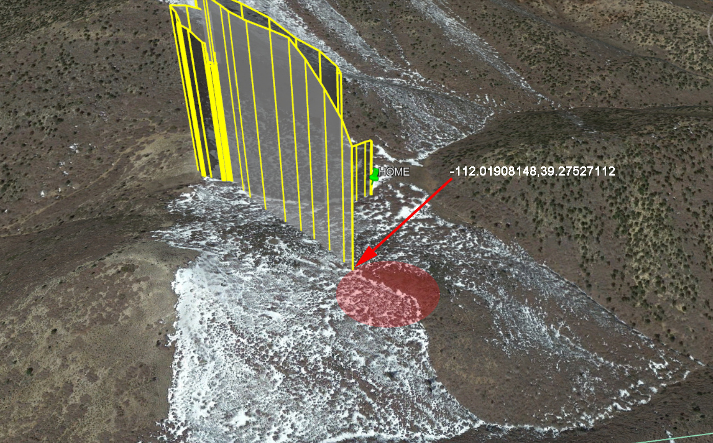
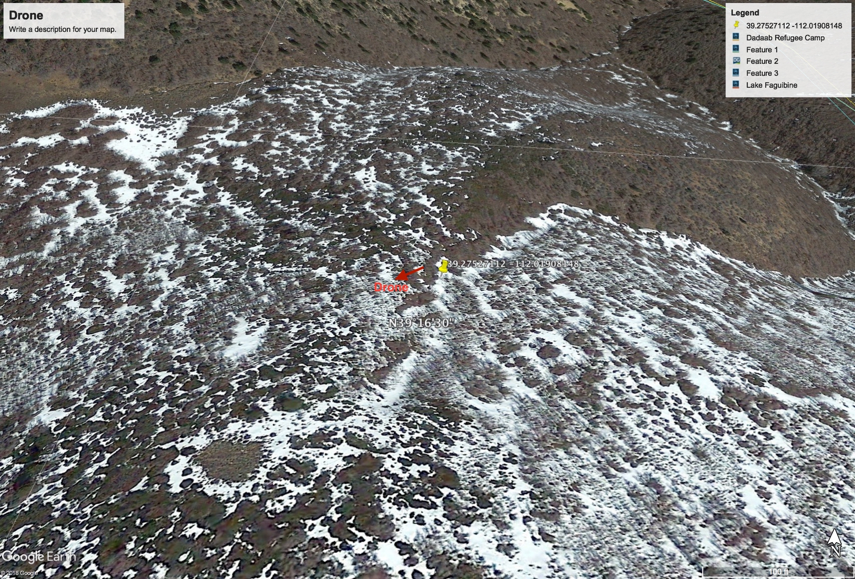
Your last logged location is shown in the image below. The aircraft was already auto landing from 150ft and should be within the red circle.
Ok thanks. One last thing. Why is the last last logged location at the edge of the red circle and not in the middle? Do you think it would have drifted more in the direction it was traveling?
The circle is extended due to the aircraft’s altitude at autoland. The edge is the last reported co-ordinance. Without wind data it is the best guess I can give you. The aircraft did not appear to be increasing in distance at signal loss, so the remaining 150ft descent should be accurate well within that area.
Ok thanks again. At that point the drone was in on last contact, would it look for a safe place to land or just go straight down and land in trees or whatever. Seriously, thanks again.
Autoland is straight down, unless there are “intermittant” RC inputs, excluding the throttle as I mentioned. Or if the winds are too strong to maintain positioning. Which even at that should be within the circle, I would think.
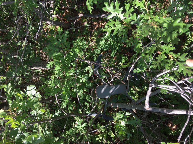
Found the Drone. It was within 50’ of that last known location. Thanks for all the help!!
Excellent! Glad you found it.
Glad you found it. I lost one in heavy brush once. Luckily I had another drone and was able to find it with the spare,
I have another drone too and took it with me the day I found it. I was going to use it as a last resort after I searched the ground. But honestly, I don’t think I would have found it with the other drone. It had flown into a dense gamble oak patch and was pretty deep and hard to see from above.