Wind data in general is not always correct in mountain areas
Craft was close to the ground end of the flight…
Hovering in that wind and holding postion with < 3 degrees pitch and roll drone angles = not to much wind around the MM.
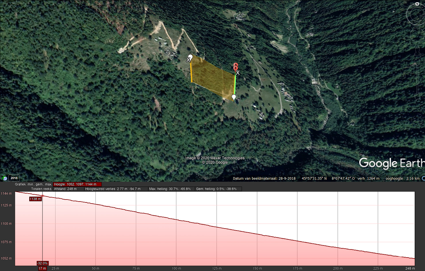
Checked the fly area, possible that the MM crashed, fly path is uphill,lowering to 105 meters relative from start point, where the last position is roughly 1144 - 1052 meters higher than start point.
last position = 45.95924100, 8.13626700.
BTW drone heading South with camera 10degrees up, so on the screen only free air was seen, not the mountain…
cheers
JJB