Hi Tristan,
sorry for the loss of your drone.
I gave a look at last 10 records of your flight log, GpsCount=18 and GpsLevel=5, so recorded positions should be very reliable. In that 0.9 seconds interval it fell 23 meters and moved NW 10 meters.
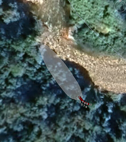
Looking at Google Earth, home point is 7 m above sea level and terrain under last recorded point 29 m. Assuming trees height more or less 20 meters, after last record of the log the drone fell around 150 m before hitting the canopy. It could be in an area between last recorded point and 60 meters NW of it, if falling heading and trend was the same of last 10 records of log:
Probably the drone is over the forest canopy, if it is as dense as you say and as it appears in GE, it will not be easy to see it.
I haven’t skills to say way the drone crashed, anyway i should contact DJI support, since it could be a warranty case.
